The Village of Waterford, Virginia
A National Historic Landmark

|
The Village of Waterford, Virginia |
| |
|
The Impacts of Development on the Landscapes of WaterfordOn the one hand, many residents take pride in Loudoun's rural history and want to preserve what remains of it. At the same time, while some scorn the "suburban sprawl" they see approaching from the east, others don't want to lose out in the development bonanza. In Waterford, the interaction of people with the landscape has created the cultural landscape which exists today. The hilly topography and Catoctin Creek are the framework of Waterford, within which the village and the farms were developed, relating closely to each other and the land. A look at each of the other character-defining features of the Waterford landscape illustrates how the loss of any one of these features will irreparably change the face of Waterford. Existing Zoning Requirements
|
 |
|
|
Expanses of farm fields bordered by hedgerows, are essential to the image of Waterford as a rural, farming community. They are evidence to both a visitors and residents of the village's history, from its importance as an agricultural center to the Civil War skirmishes fought here.
A common practice in suburban housing developments is to site homes in the center of fields. Homes sited in this manner have no relationship to historical development patterns or existing vegetation.
Under present zoning regulations, development of the farmland surrounding Waterford would result in the loss of any sense of the area's agricultural heritage. In most areas, the present zoning allows a minimum three-acre lot & 4 size. However, the lack of percolation sites and the existence of floodplains and steep slopes means that the actual average lot is about five or six acres in size. With all the land platted as typically sized lots and no land set aside as open space, the field patterns characteristic of Waterford would be lost.
A solution to the loss of Waterford's landscape character is to preserve significant portions ofopen space within the Landmark. This land can either be sold or leased as farmland, or held as open land which is mown periodically to retard the growth of shrubs and other woody species. The hedgerows, an integral part of Waterford's farm character, should be retained.
 Trees and Other Vegetation
 The farm fields surrounding the village are outlined by small stands of woods joined by hedgerows. Historically, the woodlands within the Landmark were small and most landowners had a larger woodlot on non-arable land, such as the Catoctin Mountains, outside of what is now the Landmark.
Hedgerows were traditionally used to mark the edges of fields and to control livestock. In other areas of Virginia and the rest of the country, with the move towards large, mechanized farming equipment, hedgerows have been removed to enlarge the arable areas of the fields. Waterford has largely escaped this trend, and the field boundaries follow much the same lines as they did during the 1800's.
A common practice when suburban housing developments take over farmland is the removal of all or at least a majority of the woodland. Usually the hedgerows are the first landscape feature removed to make way for new homes. Even if the hedgerows are not removed during construction, new residents will invariably "improve" them by removing many of the vines, shrubs and immature trees.
The effect that these actions would have on the Waterford landscape would be devastating. Removal or thinning of the hedgerows would not only make all new developments more visible, but also remove an historic landscape pattern. Hedgerow removal along with the siting of homes in the center of the fields results in a landscape that no longer has the character and appearance of a farm landscape, but that of tract housing and vacant land awaiting development.
When open fields are subdivided into smaller lots, new owners often respond by erecting a fence. While fences were used historically in Waterford, particularly in the village, the proliferation of new fences results in the fragmentation of expanses of open land into a patchwork of smaller, arbitrary parcels - the "mini-estate" look. While the fencing of new lots may be desirable, it must be done with some restraint in the Waterford landscape. By aligning lot lines with existing fence lines and hedgerows, and by restricting the type, style, and placement of fences, the effects of new property lines can be minimized in the landscape.
 Roads
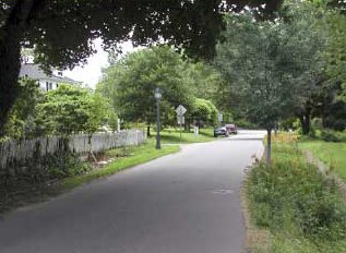
Roads Even with the existing preservation efforts, additional development in the vicinity of the village has increased traffic on the roads and streets of the Landmark. If the present development trend continues, the roads leading into the village will soon be overburdened with traffic, requiring widening, straightening, regrading and resurfacing. Loudoun County uses a base figure of 10 vehicle trips per day for each household. This could mean an additional 1000 cars traveling through the village for every 100 new homes built. More on traffic calming »
Increased road use can have a variety of effects on the village. The passage of vehicles, particularly loaded trucks, causes vibrational damage in the older buildings, particularly in their foundations. Truck traffic increases with increased development as more building materials and heavy equipment are needed. There have also been a number of incidents of vehicles running directly into buildings. In addition, if the roads were to be widened, the existing street trees would be lost, an action which would radically change the historic character of the streets and buildings.
The construction of new roads and the upgrading of existing roads can have a disastrous effect on the character of Waterford. The existing roads through Waterford are narrow and winding, often gravel surfaced, with soft or non-existent shoulders. These roads impart a timeless quality to Waterford, while requiring slower speeds through the village.
The visual effect of new roads built to subdivision standards would be immediately apparent. Asphalt paying, curbing, gutters, and wide shoulders would change the character of the existing streets and roadways. In addition, the slow speeds required by the narrow, winding roads, would no longer be a necessity, inviting traffic to flow through the village at a faster speed, increasing vibrational damage to historic walls and foundations.
The roads and driveways that access new developments can be similarly intrusive. If built with high crowns, and covered in asphalt, a number of these winding their way across the landscape would visually subdivide the existing open spaces. Therefore, siting of the new driveways and access roads and a gravel surface is critical to the protection of the visual landscape. Locating and aligning the driveways and access roads along existing hedgerows, will reduce the visual impact of new construction on Waterford's rural landscape.
An integral aspect of Waterford's character comes from the size, scale and massing of the historic homes and outbuildings, and their relationship to one another. New developments in Loudoun County typically do not have this character, being either identical, attached townhouse blocks or massive detached homes with little relationship to one another.
The number, location, orientation and spatial organization of homes sited in areas of existing farmland are critical factors for new development to ensure that it is as unobtrusive as possible. New development should not be sited on ridge lines or hill tops, and should be massed to fit in with the surrounding topography as much as possible.
The siting of new homes is very important in preserving landscape character. The first of the illustrations shows the existing conditions of the village and the open, rolling farmland to the northwest. The second image shows a conventional subdivision on the same site, large 5 to 10 acre lots with conventional subdivision streets. The third shows the same amount of development sited to preserve the landscape, clustered out of sight of the village and preserving the open farmland and historic field patterns.
From the Department of the Interior Report, "Linking the Past to the Future, A Landscape Conservation Strategy for Waterford, Virginia", 1992 Bibliography
![]()
x
|
- 11/20/2004 |